|
Watershed of the
Yellowstone River 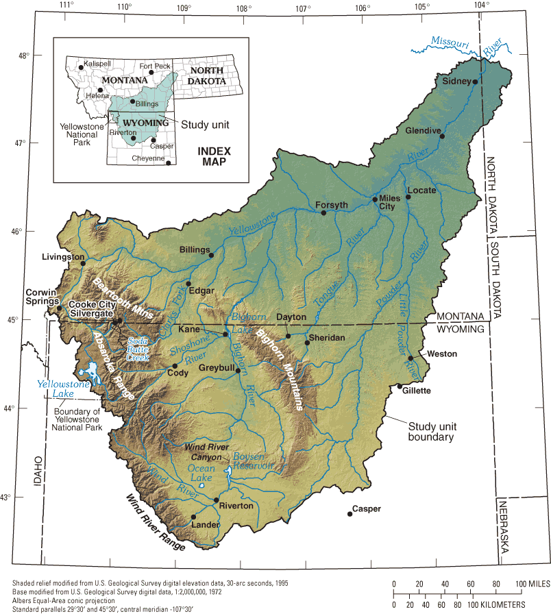
Runoff into the River . . .
This image
shows all the area that sends runoff into the
Yellowstone River. This land is referred to as
the Yellowstone River's "watershed",
"drainage basin", or just "basin". Any rain or
snow within the watershed that does not
evaporate or soak into the ground will
eventually end up in the Yellowstone River. Unfortunately, chemicals (fertilizers,
herbicides, etc.) can also be carried into the
river with the runoff. The primary source of water for the Yellowstone River is winter snow that falls in mountains within the basin during the winter. The flow of water (a.k.a. "discharge") in the Yellowstone is usually greatest in June when the snow in the mountains is melting rapidly.
Getting started . . .
As you might expect, the "headwaters"
(starting point) of the Yellowstone River are in
Yellowstone Park. The river flows northward
out of the Park to Livingston. There it turns to
the east, flowing toward North Dakota. The
Yellowstone's larger tributaries are also
shown on the map, and each of these has its
own watershed. A large portion of the Bighorn
and Powder River watersheds are located in
north-central Wyoming.
Montana's Big Three . . .
The western third of the Montana drains
into the Clark Fork River, and most of northern
Montana empties into the Missouri River.
Since the Yellowstone joins the larger
Missouri River in North Dakota, the
Yellowstone's watershed is considered to be
part of the Missouri's watershed. Since the
Missouri joins the Mississippi near St. Louis,
its watershed is part of the Mississippi's.
Unless it evaporates or is removed for use by
cities or farmers, runoff from the Yellowstone
River's watershed will end up in the Gulf of
Mexico.
Terms: runoff, tributary
|

