
|
Move your cursor over the image to see labels.
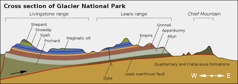
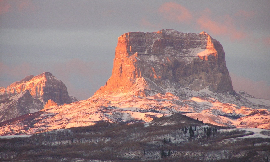
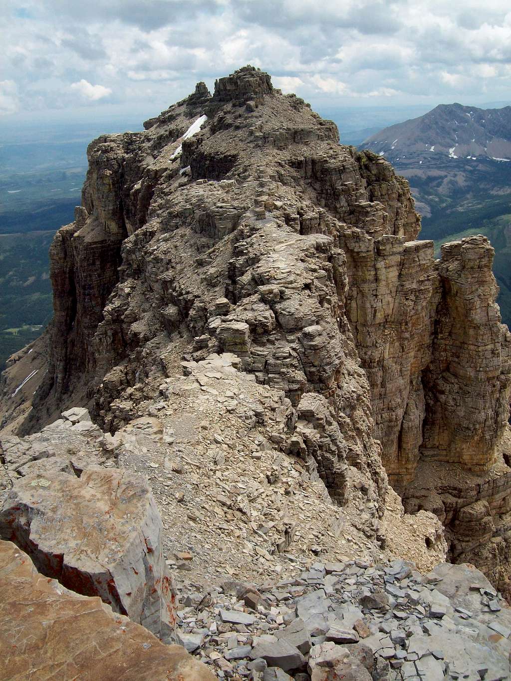
Photo courtesy of Don Bischoff Near the "Backbone of the World" . . . Located in the northeastern corner of Glacier National Park, Chief Mountain is one of Montana's most interesting peaks. For one, its height (1500 feet from base to top) and unique shape make Chief Mountain a very recognizable landmark. Since it sits on the eastern edge of the Rocky Mountains, it can be seen from miles away by those who travel the area to the east and north, including travelers on the Blackfeet Reservation and on the prairie of southern Canada to the north of the reservation. In fact the Blackfeet people and the related Blood tribe of southern Alberta regard the mountain as a sacred place. Out of order . . . Chief Mountain has also drawn attention from geologists throughout the world because of the fascinating example of overthrust faulting that it represents. The first geologists to study the rocks of the Glacier Park over 100 years ago were surprised to find that the rock layers beneath Chief Mountain are younger than the layers that make up the mountain. This is unusual because, when layers of sediment are deposited on a seafloor, the older layers lie closer to the bottom and the layers should get progressively younger toward the top. But that's not the case with the Chief Mountain and much of the rest of the park. Here the layers beneath consist of sandstones and shales, containing fossils of animals that lived during the Cretaceous time (140 to 65 million years ago). The harder layers that make up the mountains above these layers, including Chief Mountain (photo), contain no fossils and consist of sediment deposited more than 600 million years ago. (photo taken near the summit) Overthrust Theory . . . As a result of this discovery, geologists proposed that this is an area where a huge slab (layers of older rock 3 miles thick and over 60 miles from north to south) had somehow slid onto the younger layers to the east. Geologists estimate that the slab slid some 35 miles to the east over a period of about 15 million years in response to uplift to the west of the region caused by plate tectonics. The slab has been dubbed the "Lewis Overthrust". Below: In the time since the slab slid eastward about 70 million years ago, the rock around Chief Mountain has eroded away leaving it as a remnant marking the eastern edge of the great slab. The boundary (red line) between the older layers and the younger layers beneath is called the Lewis Overthrust Fault.
Term: overthrust fault |
 |
*More about the geology of the overthrust belt |
|
Past pictures of the week |
|
About this site |
|
Next picture of the week |
White Man's Dog raised his eyes to the west and followed the Backbone of the World from north to south until he could pick out Chief Mountain. It stood apart from the other mountains, not as tall as some but strong, its square face a landmark to all who passed. But it was more than a landmark to the Pikunis, Kainahs and Siksikas, the three tribes of the Blackfeet, for it was on top of Chief Mountain that the blackhorn skull pillows of the great warriors still lay. On those skulls Eagle Head and Iron Breast had deamed their visions in the long-ago, and the animal helpers had made them strong in spirit and fortunate in war. . . . from Fools Crow by James Welch |